
Buckhannon Neighbors by Record
No official block roster lists all nearby households. The useful public layers describe parcels, owners, election geography, dated city actions, or past listings. Begin with the source that matches the question. A map answers which parcels touch. The tax roll supplies owner and mailing fields. City minutes may name an applicant in a hearing. Historical directories show who was listed at an address in a given year. None proves every current occupant.
| Source | What It Shows About a Block | Access |
|---|---|---|
| WV Property Viewer | Parcel shapes, adjacent IDs, E-911 and map context | Online geometry, buffer and KMZ tools |
| WV Assessment Search | Owner, taxpayer, mailing, legal and deed fields | Online query and assessor follow-up |
| Voter records | Permitted precinct-list fields | County clerk inspection or list request |
| City minutes and ordinances | Dated street, zoning, flood and parcel actions | Online archive or specific FOIA request |
| Historical directories | Past listings and address or phone context | Archives, library, UCHS or indexed images |
Ownership and occupancy are different. A nearby owner may receive mail elsewhere. A tenant or family member may never appear on the assessment roll. Even a matching mailing address does not create a household roster. Record the parcel ID, map position, field label, and retrieval date before comparing names.
Plot Buckhannon Neighbor Parcels
The WV Property Viewer supports address, parcel-attribute, geometry, buffer, and coordinate workflows. Search the starting address or parcel, zoom until parcel shapes are clickable, select the subject parcel, then highlight or buffer the area. Capture adjacent parcel IDs and the map context before opening detail panels.
Details can include the E-911 address, physical address, owner, community, flood zone, delinquent status, building and value fields, an assessment report, external map links, and exports. Labels matter. The owner address, physical address, mailing address, and E-911 address may differ. Parcel lines are not a survey, and adjacency on the map does not prove a shared home or a social relationship.
The official viewer shown below is the right map layer for identifying surrounding parcels. Personal details should be minimized in saved notes.
Open each parcel in the separate assessment search to verify owner and address fields. The map establishes geography; the assessment record supplies the current displayed tax data.
Map a Buckhannon Block
A careful block search moves from one verified parcel to its immediate edges. It does not sweep an entire named street. That broader address chain belongs in the Buckhannon street directory.
- Locate the known address or parcel in WV Property Viewer. Save its district, map and parcel labels.
- Highlight the parcel, then use geometry or a small buffer to identify the parcels that touch or sit directly nearby.
- Open each parcel in WV Assessment Search. Compare owner, taxpayer, mailing, physical, legal-description and deed fields without assuming occupancy.
- Record the source date and any mismatch. Use the clerk for deed images, certification, or a disputed owner label.
The WV Property Assessment Search offers county, district, parcel, owner, street, legal-description, land-use, appraisal, sale, and deed book/page controls. Results can be exported and linked back to the property viewer. The query reports assessment data rather than a list of every Buckhannon neighbor.
A useful flow is: address to viewer, viewer to adjacent parcel IDs, parcel IDs to assessment records, then disputed ownership or deed book and page to the Upshur County Clerk.
Read Buckhannon Tax Map 05G
The official Buckhannon District map 05G, dated May 1, 2025, places parcel lines within a wider sheet of roads, streams, and tracts. It can help when the interactive viewer is slow or when several adjacent parcels need one stable geographic reference.
Use the sheet number and parcel labels as finding tools. The map disclaimer means the lines are not a boundary survey. Acreage and drawn edges should not settle a dispute, and a parcel that looks adjacent at one scale may need clerk records or a professional survey for legal certainty. For neighbor research, the sheet supplies context only.
- Parcel
- A tract tracked for tax and assessment purposes.
- Buffer
- A selected distance or area drawn around a mapped feature.
- Situs or physical address
- The location of the parcel, which can differ from the owner's mailing address.
- Plat
- A recorded drawing that describes lots, boundaries, or a subdivision.
Buckhannon Voters Are Not Rosters
The state voter lookup requires a first name, last name, and date of birth. It does not offer a public street browse. For lawful block or precinct research, W. Va. Code §3-2-30 permits inspection of active, inactive, rejected, and canceled voter records through the Upshur County Clerk. A read-only terminal or printed precinct list may be available under the clerk's policy.
Permitted list fields can include name, residence address, party and status. Phone numbers, email addresses, Social Security numbers, driver license numbers, and nonoperator identification numbers are excluded. The statute lists a one-cent-per-name fee for noncommercial printed or electronic data and restricts solicitation, advertising, resale, and reproduction for resale.
A voter list is not a household list. It omits those who are not registered and may show inactive or protected records under special handling. Voting history records participation, never ballot choices. Use it as election context, not as proof of who currently shares a home.
Buckhannon Block Records at City Hall
The Buckhannon council archive carries meeting and agenda posts for 2024, 2025 and 2026. Search an exact street, parcel, hearing date, ordinance, zoning action, flood matter, or drainage project. A named person must retain the role stated in the document, such as owner, applicant, representative, or speaker. A meeting mention alone does not make that person a nearby resident.
When the archive does not expose the needed record, send a specific request through the city FOIA channel. No special form is required. Name the street, map and parcel, record type, and date range. Ordinary copies are listed at 75 cents per page. West Virginia FOIA requires the custodian to act as soon as practicable and within five days, excluding weekends and legal holidays.
The city's public directory is a civic contact route, not an association roster. Its captured page shows the offices that can route a zoning, street, or city-record question.
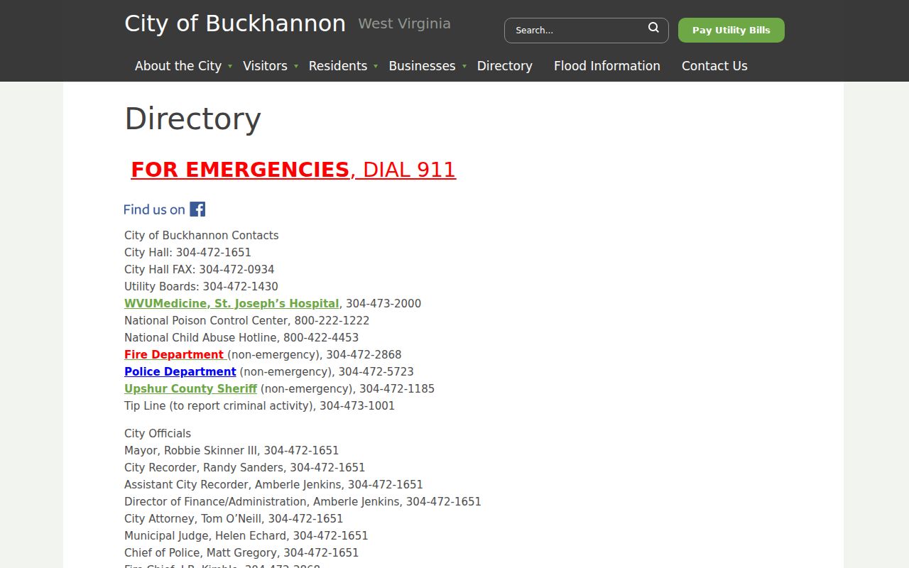
Ask for existing indexes, minutes, applications, notices, or maps rather than a newly compiled list of residents.
Buckhannon Community Directory Limits
No official Buckhannon neighborhood-association directory, HOA roster, or public block membership list was verified. Do not invent an association because a neighborhood has a familiar name. The City of Buckhannon directory and council minutes are the confirmed civic contact alternatives. Deed restrictions or subdivision papers may require research through the Upshur County Clerk.
| Community layer | Verified Buckhannon route | Access boundary |
|---|---|---|
| Neighborhood association | No official directory located | Verify organization and scope before use |
| HOA roster | No public roster located | Do not seek private member lists |
| City civic contacts | City department directory and minutes | Office contacts, not household membership |
| Historical groups | UCHS and library sources | Public histories and catalogs only |
The Upshur County Historical Society publishes church, community, family, cemetery, obituary, and map material. Those works can describe past neighborhood ties, but no current congregation, club, block-watch, or fraternal roster was found. Ask for published history or a public contact page, not private membership data.
Trace Past Buckhannon Neighbors
The present block can be compared with dated sources without confusing past and present. State Archives holdings list Buckhannon city directories from 1972 through 2016 with gaps, plus telephone directories for 1962 and 1977 through 2005. Each entry should be cited by year, volume, page or image, and the address wording printed there.
The 1900 Library of Congress bird's-eye map offers street and landmark orientation, but it is not parcel-accurate. The Charles W. Gibson Public Library is a practical first stop for local newspapers, yearbooks, obituaries and directory questions, although a complete online collection list was not verified. UCHS reports more than 25,000 artifacts or groups across over 600 collections, with catalog work still in progress and appointments used for repository access.
This layered history matters. A telephone listing may fill a city-directory gap, yet it has different coverage and may include a business. A map label may help orient an old address, but it does not identify an occupant. Mark every match as listed at a date.
Buckhannon Neighbor Source Comparison
Commercial neighbor tools may blend tax, voter, directory, court, phone, business, and marketing data. Their results can contain stale addresses, inferred relationships, and same-name errors. Official records are narrower, but they state the office, field, and date that produced each fact.
| Source type | Useful for | Key limit |
|---|---|---|
| Official parcel and city records | Named fields, map context and dated public actions | Owner or participant does not mean occupant |
| Archives and directories | Past listings tied to a source year | Historical only and sometimes incomplete |
| Commercial compiled tools | Possible lead for later verification | Not a custodian; data may be stale or inferred |
For Buckhannon neighbors, use the compiled category only as an unverified lead. Return to the parcel viewer, assessment roll, clerk, city archive, library, or Archives before stating a connection.
Privacy for Buckhannon Neighbors
Renters and household members generally do not appear in property ownership data. Utility customer and delivery records were not found as public resident sources. Sealed court files, restricted vital records, and protected identifiers may also be withheld. Absence from a portal is not proof that a person does not live on the block.
West Virginia's Address Confidentiality Program provides a substitute address for eligible survivors of domestic violence, sexual assault, stalking, and human trafficking. It can be used for mail, voter registration, DMV, and schools. Do not reverse-search or compare an ACP address to GIS and parcel output. Omit it from notes meant for others.
Lawful use. Research Buckhannon neighbors only for lawful personal purposes. Never use public data to watch, harass, intimidate, or expose another person.